Government
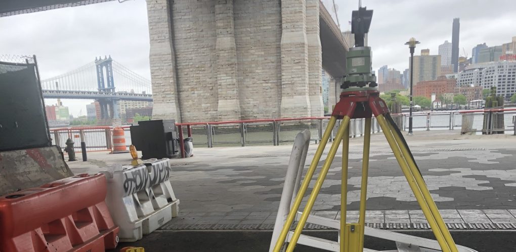
NYCEDC Seaport Coastal Resiliency
- Owner: New York City Economic Development Corporation (NYCEDC)
- Completed: October 2024
- Services: Land Surveying Services
MFS Engineers & Surveyors provided professional surveying services for the NYCEDC Seaport Resiliency Project located in the borough of Manhattan, New York.
MFS performed a topographic field survey to the locate the apparent accessible above ground physical features, such as, but not limited to, decks, piers, buildings, curbs, edge of pavement, drives, striping, sidewalks, fences, walls, utility/light poles, signs, street trees, tree lines. First floor/garage floor elevations were determined at doorways. Cross sections of paved surfaces were surveyed at a minimum of 50’ intervals and at low/high points. Spot elevations were obtained at a spacing sufficient to develop contours at an interval of one foot. Breakline features such as top/bottom of curb, edge of pavement, top/ bottom of slopes/swales/banks/walls, etc. were located.
At waterways the surveys extended to the edge of water at low tide. MFS performed an aerial survey within the project limits. This surveying work was accomplished photogrammetrically from new winter/leaf-off aerial imagery. To ensure the highest quality results, new Digital RGB Imagery was acquired at 4.0cm GSD. Additionally, several targeted photo control points were surveyed and used to perform the aero triangulation on the imagery. All visible planimetric features were digitized from the imagery using one of our state-of-the-art softcopy stereo workstations. To further enhance the accuracy of our mapping work, terrain break lines and spot elevations were digitized and combined with the ground planimetric data to create a Digital Terrain Model (DTM) from which the one-foot contours were generated. The mapping was delivered in AutoCAD Civil 3D format.
MFS’s field personnel conducted the necessary fieldwork to locate evidence of right of way lines, including but not limited to property markers, monuments, crosscuts, fences, walls, buildings, and curb lines. MFS also conducted web-based searches to obtain current deeds of the properties within the survey area. MFS’s office personnel obtained information from the Borough’s Topographical Bureau pertaining to the property lines, right-of-way (ROW) lines, and easements. MFS conducted a utility survey of accessible surface utilities and surface hardware within the project limits. These utilities included manholes, catch basins, trench drains, valve covers, utility/light poles, hydrants, conduit, wires, and other similar items. Additionally, MFS located any apparent utility mark-outs visible at the time of the field survey that were marked out by others. For storm drains and sanitary sewers, MFS attempted to obtain measurements to determine inverts and pipe sizes at accessible manholes and catch basins. MFS surveyed any apparent sewers within the survey limits and located any apparent and accessible outfalls along the shoreline within the survey limits, as well as one associated upstream sewer structure, where accessible.
Subsurface utilities lines, including water, gas, electric, and communication, were depicted based on surface features and available record mapping. Depiction of subsurface utilities lines were based on the location of surface hardware structures, record documents and any mark-out recovered. Subsurface Utility Engineering (SUE) was performed utilizing Electromagnetic utility locating in compliance with Quality Level “B” of CI/ASCE 38-02, Standard Guideline for the Collection and Depiction of Existing Subsurface Utility Data, hereinafter referred to as Standard 38-02. Any non-locatable utilities discovered through record information or otherwise were shown on the drawings at Quality Level “C” or “D”. SUE operations targeted the centerline of utilities to be picked up during the topographic field survey scope by MFS’ survey department. Tunnels, wide ducts, etc. when the configuration is known, may be marked with paint to approximate each side of the system.
MFS utilized a subconsultant to perform bathymetric survey. The survey was performed with multibeam sonar. The bathymetric survey was such that contours at a one-foot interval of the waterway bottom will be provided. All bathymetric data were incorporated into the survey base map that will be part of the final
deliverable. MFS performed vault survey investigations, and vault surveys at structures within the project extents to determine if a vault exits within/ below the structure, the depth of each vault from sidewalk level to the top of the vault roof, as well as the extent of the vault from the building line. When permissible,
MFS entered the vault and performed the survey, measuring and recording the vault extents into the right-of-way and photo document the existing utilities within the vault structure.