Company Articles
Why Fall is the Ideal Time for Aerial Mapping
Oct 01, 2026

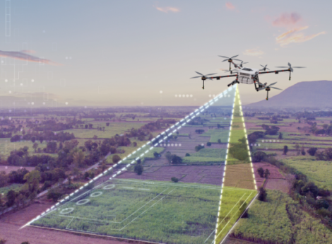
At MFS Engineers & Surveyors, aerial mapping is planned around each project’s purpose, scale, site conditions, accuracy requirements, and intended engineering use. That planning determines whether a manned fixed-wing aircraft, UAS/drone system, LiDAR acquisition, or a combination of methods is the most appropriate approach.
Mapping, Not Just Photography
Professional aerial mapping is more than aerial photography. It combines high-resolution imagery, precise positioning, ground control, photogrammetry, LiDAR where appropriate, and specialized processing to convert existing site conditions into measurable digital information.
For fixed-wing projects, large-format digital cameras collect mapping-grade imagery while airborne GPS records aircraft position and altitude. Surveyed ground control and check points then tie the imagery to the project coordinate system.
After collection, the imagery is processed through aerotriangulation and photogrammetric workflows. This allows mapping specialists to view the ground in three dimensions, identify physical features, and develop planimetric and elevation information.
Common deliverables include:
Deliverables can be formatted for common engineering and design platforms, including AutoCAD and MicroStation, and incorporated into client CAD standards and workflows.
Choosing the Right Aerial Mapping Platform
Manned fixed-wing aircraft are often the best fit for large sites, infrastructure projects, and long linear corridors because they can efficiently cover extensive areas in a single mission while carrying professional aerial cameras and LiDAR systems designed for high-accuracy mapping.
For right-of-way projects, this approach supports consistent mapping across miles of roadway, utility corridor, rail alignment, pipeline, or other linear infrastructure.
Flight altitude is planned around the required ground sampling distance, map scale, contour interval, and project accuracy requirements. Ground targets, photo-identifiable control, and check points are used during processing to support accuracy and quality control.
For projects requiring elevation information, aerial LiDAR can supplement or replace portions of the photogrammetric elevation workflow. LiDAR provides direct laser measurements of the ground and can be especially useful where terrain, vegetation, or project requirements make laser scanning advantageous.
Drone Mapping for Smaller Sites
Drone mapping provides a flexible option for smaller areas, private tracts, construction sites, and other projects where UAS can efficiently collect the required data.
Drones can support many of the same deliverable types as manned aircraft, including imagery, photogrammetric models, orthophotos, point clouds, and elevation data. The deciding factor is not the data type alone, but whether the platform is practical for the site size, access, airspace, schedule, and accuracy requirements.
UAS operations are subject to additional operational limitations, including airspace restrictions and visual line-of-sight requirements. As a result, a drone may be an excellent solution for a multi-acre site but not the appropriate tool for a multi-mile transportation or utility corridor.
Why Fall Can Be an Advantage
Aerial mapping can be performed year-round but fall and leaf-off conditions can provide important advantages for certain projects.
As foliage thins, more ground features are visible from the air. For projects where ground identification is important, leaf-off photography can provide a more complete view of existing conditions.
Improved visibility can be especially helpful when developing terrain models, identifying drainage features, mapping pavement edges, or establishing breaklines used to define the ground surface.
Fall collection can also establish a current baseline before winter weather or construction activity changes site conditions, supporting design, permitting, right-of-way acquisition, or construction documentation.
Leaf-off conditions are not required for every project. The best collection season depends on project goals; for example, color infrared photography may be collected during leaf-on conditions when vegetation analysis is part of the scope.
From Aerial Data to an Engineering-Ready Surface
Once data is collected, the value of aerial mapping comes from converting imagery and sensor measurements into accurate, engineering-ready information.
For photogrammetric mapping, overlapping aerial photographs provide stereo coverage so mapping specialists can view and compile features in three dimensions, then supplement the imagery with surveyed information and breaklines where necessary.
Elevation data can be used to build a Triangulated Irregular Network (TIN) or Digital Terrain Model, often one of the most valuable products produced from an aerial survey for engineering applications.
A terrain model can support:
Digitally rectified orthophotos are processed to account for camera orientation, terrain, and other distortion, producing aerial photographic maps that align with the project coordinate system and can be used alongside CAD and GIS data.
Aerial mapping also works best when coordinated with field surveying. Field crews supplement aerial data by surveying features obscured from the air, such as areas beneath bridges, and by identifying utility and drainage structures that cannot be reliably classified from imagery alone.
Corridor and Infrastructure Mapping
For infrastructure and right-of-way projects, aerial mapping helps teams understand conditions across an entire corridor rather than relying on isolated observations at individual locations.
Fixed-wing imagery, often supplemented with LiDAR, provides a coordinated corridor-wide dataset that can be reviewed, incorporated into design, and used throughout project planning and management workflows.
Plan Your Fall Mapping Project
Early planning helps ensure the right data-collection method, season, flight parameters, ground control, and deliverable formats are aligned with the project’s intended use. For many projects, fall provides an excellent opportunity to establish an accurate baseline before weather or construction activity changes site conditions.
MFS Engineers & Surveyors provides aerial mapping and surveying services for public- and private-sector clients throughout the Northeast and the Caribbean. Capabilities include fixed-wing aerial photography, LiDAR acquisition, drone-based mapping, surveying, photogrammetry, CAD, and engineering support.
For transportation, utility, development, right-of-way, construction, or infrastructure projects, contact MFS Engineers & Surveyors to discuss the aerial mapping approach that best fits your site, schedule, and accuracy requirements.