Government
Coney Island Creek Resiliency Project
- Owner: New York City Department of Parks & Recreation
- Completed: September 2026
- Services: Photogrammetry and Aerial LiDAR
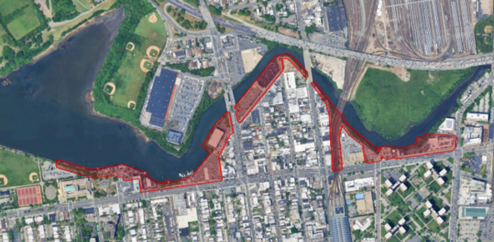
MFS Engineers & Surveyors provided topographic basemapping and photogrammetric services for five coastal areas along Coney Island Creek in Brooklyn, New York. The project included topographic mapping at a scale of 1”=20’ with rectified orthophotography covering the designated project areas. Photo control targets were established and surveyed prior to the aerial acquisition to provide the necessary control for subsequent photogrammetric processing.
New low-level digital aerial imagery was acquired during low-tide conditions at a 2.0 cm ground sampling distance (GSD) and processed through digital aerial triangulation, Visible planimetric features, including both man-made and natural features, were compiled photogrammetrically using softcopy digital stereo plotters. The resulting three-dimensional data was formatted in AutoCAD for incorporation into the project basemapping.
A Digital Terrain Model (DTM) was developed in Civil 3D using three-dimensional breaklines and ground-level features compiled through the photogrammetric process. One-foot contours were generated from the completed surface model to provide detailed representation of existing ground conditions throughout the project areas.
The aerial imagery was orthorectified at a 3-inch pixel size and delivered in GeoTIFF and ECW formats with accompanying world files. Mapping and orthophotography were performed by experienced technicians under the direct supervision of MFS’s certified photogrammetrists. The completed mapping products were prepared to meet or exceed ASPRS Positional Accuracy Standards for Digital Geospatial Data and applicable project standards.