Waterfront & Marine
PVWC Paterson Topographic Survey
- Owner: Passaic Valley Water Commission (PVWC)
- Completed: June 2025
- Services: Land Surveying Services
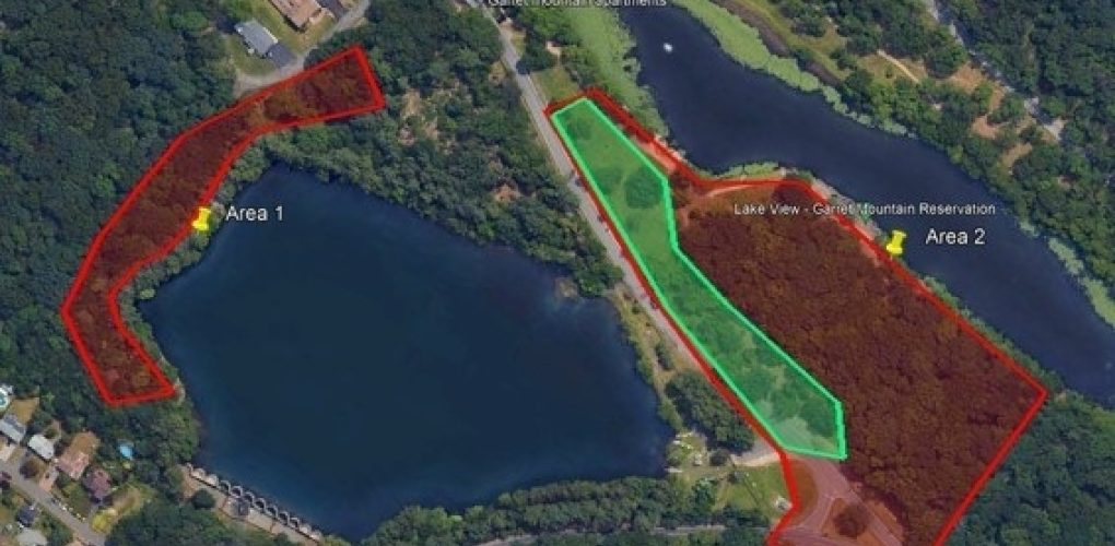
MFS Engineers & Surveyors provided professional land surveying services for two areas of PVWC property around Rifle Camp Road.
The horizontal control was established in the field by GNSS RTK observations utilizing two primary control points. Additional control points were set and located by conventional traversing procedures. The horizontal control was tied to the appropriate State Plane Coordinate System NAD83, US Survey Feet. The vertical datum was tied to NAVD88 by a level run from known NGS Vertical benchmarks or GNSS RTK observations.
Within the limits of Survey Area 1 and 2, MFS performed a topographic field survey to locate the apparent accessible above-ground physical features, such as buildings, curbs, edge of pavement, drives, striping, sidewalks, fences, walls, utility/light poles, signs, street trees, and tree lines. First-floor/garage floor elevations were determined at doorways. Cross-sections of paved surfaces were surveyed at a minimum of 50-foot intervals and at low/ high points. Spot elevations were obtained at a spacing sufficient to develop contours at an interval of one foot. Breakline features such as top/ bottom of curb, edge of pavement, top/ bottom of slopes/ swales/ banks/ walls, etc. were located.
A table showing the wetland/SOW delineation line courses and distances was also included.