Government
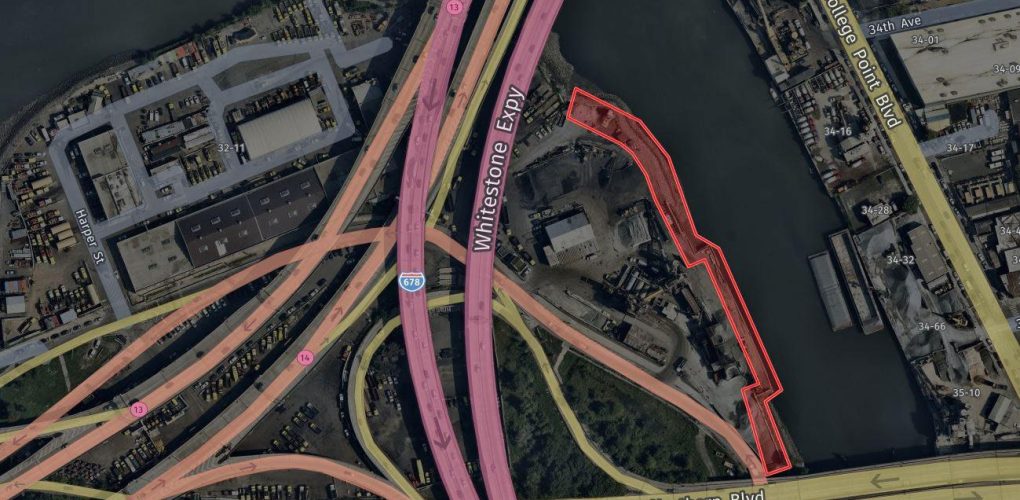
Harper Yard Asphalt Plant Waterfront Imagery Survey 30-01 Harper Bay Willets Point, Queens, NY
- Owner: New York City Economic Development Corporation
- Completed: June 2023
- Services: Land Surveying Services
MFS Engineers & Surveyors provided professional land surveying services in support of the Harper Yard Asphalt Plant Waterfront Imagery Survey project.
MFS performed an aerial survey within the project limits. GEOD provided services including a combination of both aerial photogrammetry and aerial LiDAR to develop the topographic mapping. New 2.2 cm GSD low level digital aerial imagery was acquired, controlled, and processed through aero triangulation. GEOD acquired aerial LiDAR at a density of 20 ppm² which was calibrated to the project horizontal and vertical datums and then classified to define the ground LiDAR point cloud. Both the imagery and LiDAR data was collected within one hour of low tide as predicted for Tidal Station: Kings Point, NY, (Station ID: 8516945).
All visible planimetric features, both natural and man-made, were compiled photogrammetrically at 1” =30’. Terrain break lines and spot elevations were digitized and combined with the ground level planimetric data and the ground class of LiDAR data to create a Digital Terrain Model from which the 1 ft contours were generated. The mapping was performed by skilled technicians under the direct supervision of Certified Photogrammetrists to exceed ASPRS Positional Accuracy Standards for Digital Geospatial Data.